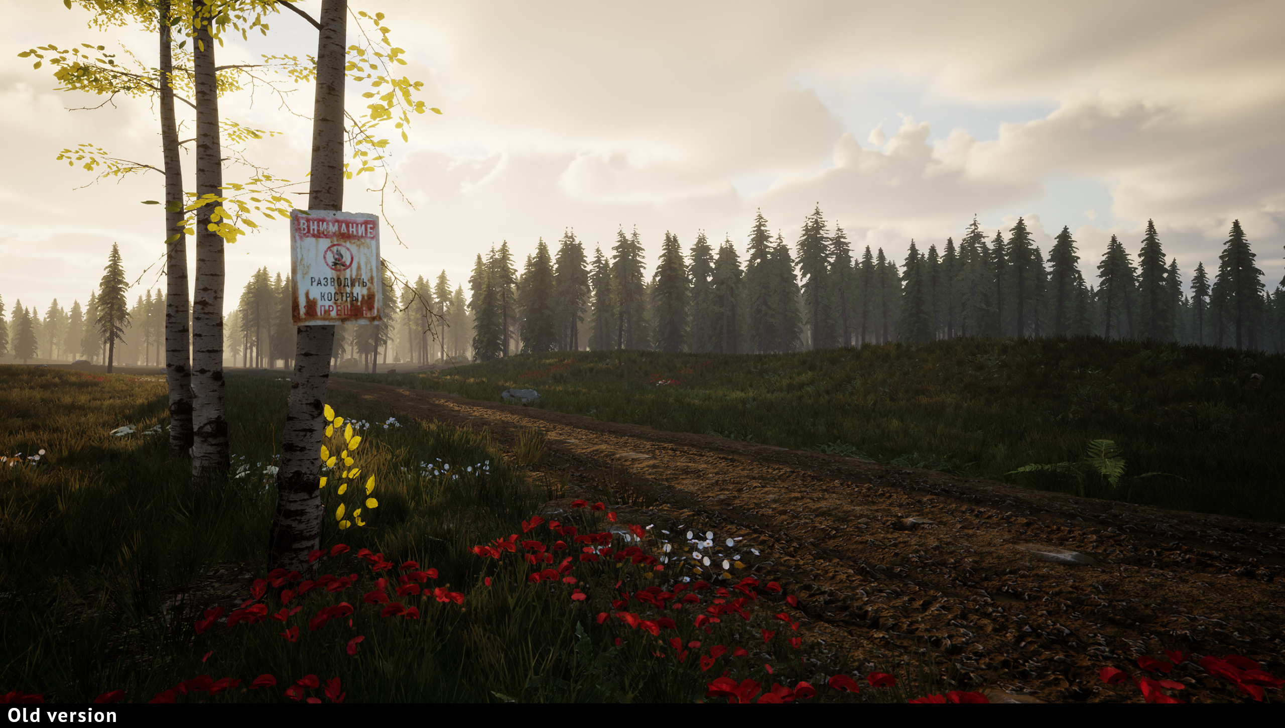
After a long time of silence, we are finally ready to share something. For now, it’s mostly tech stuff. We switched to the new forest and water systems (which are 90% of all in-game visuals), and also tuned the environment lighting.
Foliage and ground, roads and trails - now with much more details and less motleyness.
A few examples: All visuals are still work in progress
Another very important aspect that’s being improved is the water system. Real Tunguska Reserve full of rivers, creeks, lakes and swamps. Moreover, water bodies played a crucial role in the life of local tribes in terms of navigation. The look and shape of the river can be an excellent landmark, no less than streets and highways in modern cities.
Keeping all these points in mind, a high quality water system is one of the top priorities for us. We already tried a few solutions, and are still in the search of the best option. You can see current implementation below:
Work on visuals is always a tradeoff between beauty and performance. It’s kinda hard to optimize 3rd party assets, but we are trying to keep an eye on that field, too.
And as always, a very big thanks to everyone who waits and follows our game!
In touch, Dividebyzer0 team
DevLog #2 The Map
Scale and orientation
From the beginning to the end of the game, a map, as well as a compass, will be your primary navigation tool. Let’s start with the most important aspects that must draw your attention, no matter what kind of map you are using: scale and orientation.
Most maps in real life are oriented to the North direction. Meaning that the North is always directed toward the top of the map, and South - to the bottom, respectively. The directionality of the map is usually depicted as an arrow with an “N” symbol.
But even in our game, you may face maps with a different orientation. For example, it could be a sketch drawing of a particular place, made in a hussle, so the orientation of the map will have a direction that was convenient to the sketch’s author at that moment.
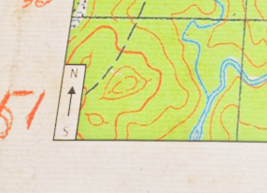
The second important aspect of any map is scale. Scale, to put it simply, is a relationship between distance on the map and distance on the ground. Usually, the map represents its scales both in numerical (as a ratio) and graphical (as a bar) forms, making distance measuring more convenient.
The Grid
Many maps also have a grid - a regular pattern of parallel lines intersecting at right angles and forming squares. Usually (but not always), the grid square side length equals scale bar length.
The grid helps you determine your location faster and more accurately, and it also can be used to quickly measure distance.
For more accurate distance measuring, you can use a ruler on the compass side while in Planning mode.
Another important feature of the grid is to give each point in the map an identifier, by which it can be referred to. For more precise addressing, a “by snail” technique is being used* - imagine a 3x3 grid inside a given square, with a list of numbers in a particular order. Using these numbers will help you to refer to a particular location more quickly and accurately.
*This technique (“ориентирование по улитке”, rus.) was used in the Soviet military so you may find something similar but with a different name in your country.
Custom notes
For highlighting points of interest, landmarks, and other objects, players can use a simple drawing system while in Planning mode.
We had a crazy thought to implement a “pen with a limited ink” feature but eventually rejected it.
We hope this entry was entertaining and valuable to our players. In the next Devlog, we will talk about what to do in case you are lost.
Thanks for your time!
DevLog #1
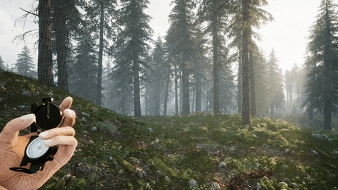
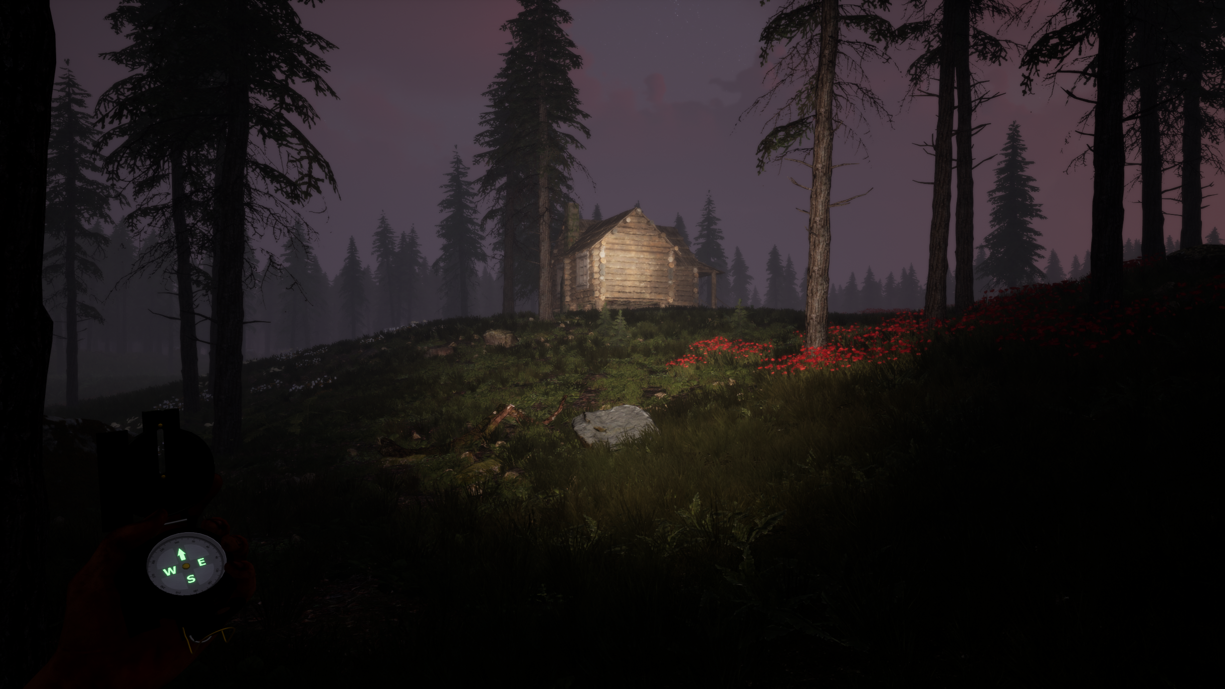
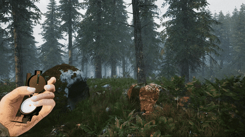
Magnetic compasses have been helping mankind to travel since ancient times. In TUNGUSKA: A Call in the Woods this little fellow will be a prime tool in navigation and surviving the Tunguska Nature Reserve.
The main purpose of the compass, of course, is to point out where north is, and thus, determine the cardinal directions. The key points and the north end are covered with self-luminous material so the compass is readable even at night.
It's important to notice, that real-life orienteering with magnetic compasses often requires calculating magnetic declination (especially at larger scales) - an angle between magnetic north and geographical north. This phenomenon isn't covered in our game. However, the in-game compass can be affected by ferromagnetic alloys in soils which are rather common for this region. Players need to be extra careful near them to prevent false bearing - there are no happy rescue endings in deep taiga woods.
Second important role for the compass is measuring distance. Players can turn on Planning Mode*, in which the compass lies on top of the map. You can pan and rotate the compass, using its side ruler for measuring distance. Be advised that different maps use different scales. *The feature is subject to change
Last but not least, the compass can warn you about danger. Some anomalies can be detected by a shaking compass in the hand. Coming too deep in these zones probably will have a lethal outcome, so watch your step.
In the next DevLog we’ll be covering a Map and all features alongside it.